")
Site mapping, inspections, thermal imaging, and aerial imagery for construction and commercial property across the six-county Tampa Bay no-mileage area.
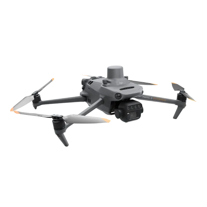
A general contractor and a commercial property manager have very different jobs, but both increasingly reach for the same tool. A commercial drone provider can document a job site, inspect a roof, find moisture with thermal imaging, and capture marketing imagery of a property, all from the air and all faster and safer than the ground-based alternatives. For general contractors and property managers across Tampa Bay, the question is less whether to use drone services and more which ones fit the job.
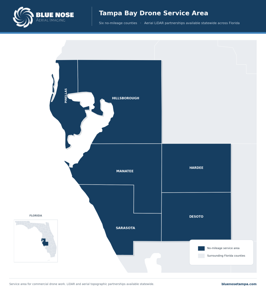
This guide lays out the range of commercial drone services available across Pinellas, Hillsborough, Manatee, Sarasota, Hardee, and DeSoto, how contractors and property managers use each, and what separates a professional provider from someone with a consumer drone.
The Range of Commercial Drone Services
Site mapping and progress documentation
Aerial maps and 3D models of a job site support progress tracking, verification against plans, and stakeholder reporting. The aerial mapping guide covers this in depth.
Roof and facility inspections
Documented inspections of roofs, facades, parking structures, and rooftop equipment are captured from the air without putting people at height. The commercial roof inspection pillar and the drone inspection guide go deeper on these.
Thermal imaging
Radiometric thermal scans find trapped roof moisture, faulty solar components, and building-envelope heat loss. The drone thermal imaging guide covers the technique and its applications.
Aerial imagery for marketing and leasing
High-resolution aerial photos and video of a completed building or property serve marketing, leasing, and brand use, showing a commercial property at its best from angles the ground cannot reach.
LiDAR data for surveying-firm partnerships
For projects that involve a licensed surveying firm, Blue Nose Aerial Imaging of Tampa Bay provides aerial LiDAR data as a subcontract partner, with the firm remaining the professional of record. The aerial LiDAR mapping pillar owns this lane, which operates statewide.
Insurance and storm documentation
Pre-storm baselines and post-storm damage documentation across a property support the claims process with dated, located imagery.
How General Contractors Use Drone Services
A general contractor uses drone services across the life of a project. A preconstruction flight documents the starting site. Regular mapping tracks progress and feeds stakeholder reports. Verification flights check work against the plans before it becomes permanent. Roof and facility inspections document conditions during the build and at handover. Aerial imagery captures the finished project for marketing and portfolio use. And a dated record across all of it helps resolve disputes and document the project at closeout. One provider can cover that whole arc, which is simpler than coordinating several.
How Property Managers Use Drone Services
A commercial property manager uses drone services across a portfolio rather than a single build. Roof and facility inspection programs keep eyes on each asset on a schedule. Pre-storm baselines protect the portfolio’s claims position before hurricane season, and post-storm flights document damage quickly across many buildings at once. Thermal scans catch roof moisture and equipment faults early, before they become emergencies. And aerial imagery supports leasing and marketing across the portfolio. The common thread is a consistent, documented view of every property without sending people onto roofs and up ladders.
What Sets a Professional Provider Apart
Anyone can buy a drone, so the gap between providers is wide, and it shows up in the deliverable. For commercial work that supports decisions, reporting, and claims, look for FAA Part 107 authority, commercial liability insurance, current-generation sensors including thermal where the work needs it, and a provider who delivers documented, well-processed data rather than raw images. Our Director of Operations is a 747 captain and Airline Transport Pilot, an FAA Part 107 remote pilot, with a master’s in Aeronautics specializing in Aviation Human Factors. The standards behind each flight come from commercial aviation.
What Requires a Licensed Surveyor
Some needs are not drone services in the commercial sense. Boundary determinations, recorded surveys, plats, and topographic surveys are regulated under Chapter 472 of the Florida Statutes and require a licensed Professional Surveyor and Mapper. Blue Nose Aerial Imaging of Tampa Bay provides aerial data and refers survey-of-record work to licensed firms. The drone survey article explains where that line falls.
Where Blue Nose Aerial Imaging of Tampa Bay Serves
Blue Nose Aerial Imaging of Tampa Bay provides commercial drone services with no mileage charges across six counties: Pinellas, Hillsborough, Manatee, Sarasota, Hardee, and DeSoto.
For LiDAR partnership work with surveying firms, Blue Nose Aerial Imaging of Tampa Bay operates statewide across Florida. Other projects beyond the no-mileage area are scoped with travel factored in.
What It Costs and How to Start
Aerial data capture, including mapping and inspections, typically ranges from $750 to $3,500 per site, depending on the size and complexity of the work and the deliverables. LiDAR partnership missions typically range from $2,500 to $9,500. Blue Nose Aerial Imaging of Tampa Bay provides a written scope and a price after a short scoping conversation about the project and what it needs to accomplish.
Frequently Asked Questions About Commercial Drone Services
What commercial drone services does Blue Nose Aerial Imaging of Tampa Bay offer?
Blue Nose Aerial Imaging of Tampa Bay offers aerial site mapping and progress documentation, roof and facility inspections, radiometric thermal imaging, aerial imagery for marketing and leasing, LiDAR data capture for surveying-firm partnerships, and pre-storm and post-storm documentation. Each is captured under FAA Part 107 authority and delivered as documented data.
Do you work with general contractors?
Yes. General contractors use Blue Nose Aerial Imaging of Tampa Bay across a project for preconstruction documentation, progress mapping, verification against plans, inspections, and finished-project imagery. Using one provider across the whole project is simpler than coordinating several.
Can property managers use drone services across a portfolio?
Yes. Property managers use Blue Nose Aerial Imaging of Tampa Bay for roof and facility inspection programs, pre-storm baselines, post-storm assessments, thermal scans, and leasing imagery across multiple buildings, which gives a consistent documented view of each asset without putting people at height.
Are your pilots licensed and insured?
Yes. Blue Nose Aerial Imaging of Tampa Bay operates under FAA Part 107 authority with commercial liability insurance, and the Director of Operations holds a master’s in Aeronautics with an Aviation Human Factors specialization, an FAA Part 107 certificate, and an Airline Transport Pilot certificate as a 747 captain. Additional insured certificates are available per project.
Do you offer drone services beyond Tampa Bay?
Yes. The six no-mileage counties are Pinellas, Hillsborough, Manatee, Sarasota, Hardee, and DeSoto. LiDAR partnership work runs statewide across Florida, and anything else outside the no-mileage area is taken on with travel built into the quote.
How much do commercial drone services cost?
Most aerial data capture, including mapping and inspections, falls between $750 and $3,500 per site, while LiDAR partnership missions run $2,500 to $9,500. Where a job lands comes down to its size, complexity, and deliverables, and the figure is set during a short scoping call.
Request a Drone Services Quote
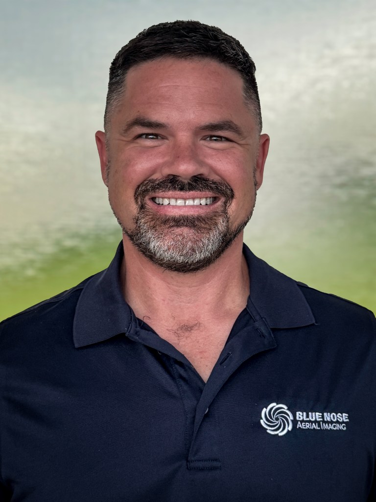
Rob Smith
Director of Operations, FAA Part 107 certified
Every drone services project starts with a quick conversation. Rob Smith, our Director of Operations, will help you scope the right package for your project or property and answer your questions on a call.
What to expect on the call:
- We learn about your site or portfolio and what you need to capture.
- We recommend the right drone services and timeline.
- You get a clear, no-pressure quote.
You can also reach the team at 941-376-3396.