")
Orthomosaics, 3D site models, and progress documentation for active job sites across the six-county Tampa Bay no-mileage area, delivered in 24 to 48 hours.
A construction project manager runs on current, accurate information about the job site, and a stack of phone photos does not provide it. Aerial mapping does. A drone flies the site, and within a day or two the project manager has a sharp, georeferenced map of the entire project that overlays onto the civil drawings, shows exactly what was built where, and documents conditions for everyone who needs to see them.
For construction project managers, superintendents, and general contractors across Pinellas, Hillsborough, Manatee, Sarasota, Hardee, and DeSoto, aerial mapping has become a standard tool for running a site. This guide covers what aerial mapping produces, how project teams use it across the build, the cadence that makes sense, and what to expect from a provider.
One clarification before the detail. Aerial mapping for construction is documentation, not a survey of record. For boundaries, plats, or anything that requires a sealed survey, a licensed surveyor is needed, as covered in our drone survey guide. Everything below is operational site documentation.
What Aerial Mapping Produces
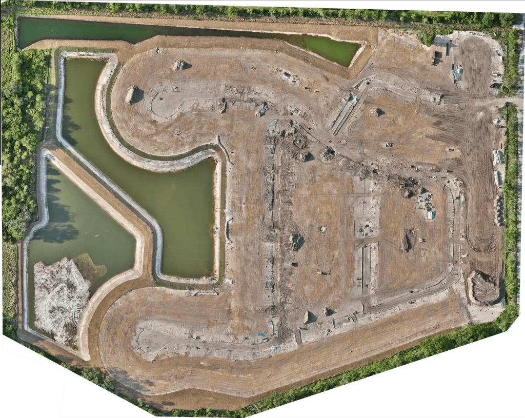
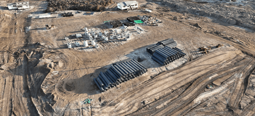
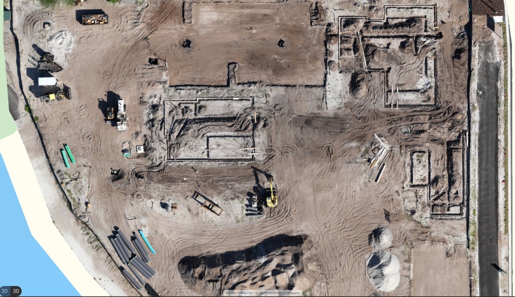
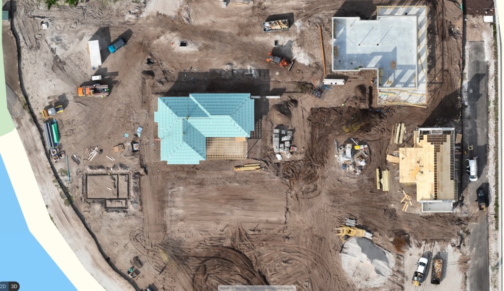
Orthomosaic maps
This is the most common deliverable. Dozens or hundreds of overlapping drone photos are stitched and geometrically corrected into a single sharp top-down image of the whole site, where every feature sits in its real-world location. It looks like a satellite image captured the morning you flew it, at high resolution, and it overlays directly onto the civil drawings.
3D site models
A three-dimensional model of the site is built from the same imagery, useful for visualizing grade, viewing the site from any angle, and sharing a clear picture with stakeholders who are not on site.
Progress maps over time
The same site flown on a schedule produces a dated sequence of maps that shows exactly how the project has advanced between flights. That sequence is the backbone of progress reporting.
Site elevation and contour data
Aerial data can produce elevation and contour information across the site to support earthwork tracking and site management. This is operational data for managing the build, not a sealed topographic survey. Where a project needs elevation data at a higher specification through a licensed partner, see aerial LiDAR mapping.
Cut-and-fill and stockpile documentation
Numerical documentation generated from the aerial data shows earthwork moved between flights and stockpile quantities on site, which project teams use to track progress and reconcile against delivery tickets.
How Construction Teams Use Aerial Mapping

Preconstruction baseline
A flight before work begins documents the starting conditions of the site, which gives the team a reference point for everything that follows and a record of what was there before mobilization.
Progress tracking and stakeholder reporting
Regular maps give ownership, lenders, and the project team a clear, current view of progress without a site visit. A dated map series answers the “where are we” question with evidence instead of narrative.
Verifying work before it becomes permanent
A superintendent compares the map to the plans before a major pour, checking footing placement, foundation alignment, and utility trenching against design. Catching a discrepancy before concrete is far cheaper than after.
Earthwork and stockpile documentation
Cut-and-fill and stockpile documentation let the team track earthwork progress and reconcile material quantities against tickets, which supports both site management and subcontractor accounting.
Dispute resolution and closeout
A dated map record settles questions about what was built where and when, which is valuable for resolving subcontractor disputes and for documenting the project at closeout.
The Workflow and Cadence
The workflow is quick. Blue Nose Aerial Imaging of Tampa Bay flies the site early in the day, processes the imagery through photogrammetric software, and delivers the orthomosaic and any other products within 24 to 48 hours. On an active project, a weekly or biweekly cadence keeps the documentation current enough to drive decisions and reporting, and the cadence is set to match the pace of the work.
Why Aerial Mapping Beats Phone Photos and Manual Methods
A folder of phone photos shows isolated moments from wherever someone happened to stand. An aerial map shows the entire site uniformly, in one georeferenced picture, on a known date. The difference shows up in every downstream use: progress reports become a map instead of a slideshow, verification becomes an overlay instead of a memory, and disputes get settled with a dated record instead of an argument. For a large or fast-moving site, that single source of truth saves time across the whole team. For a side-by-side of aerial against traditional methods, see drone mapping vs. traditional mapping.
What to Look for in an Aerial Mapping Provider
Drone operators are easy to find and hard to tell apart, so deliverable quality varies widely. For construction documentation that supports decisions and reporting, look for FAA Part 107 authority, commercial liability insurance, current-generation sensors, and a provider who delivers documented, well-processed data rather than raw images. Behind Blue Nose Aerial Imaging of Tampa Bay’s flights is a Part 107 remote pilot who is also a 747 captain and Airline Transport Pilot, with a master’s in Aeronautics and a specialization in Aviation Human Factors, and each map is flown and processed to standards that hold up in a stakeholder report or a dispute. Aerial mapping is one of several commercial drone services the team runs for construction and property clients.
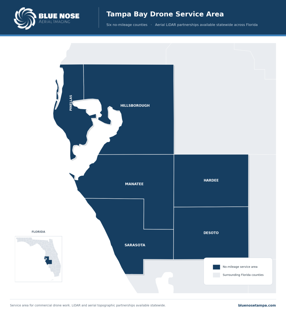
Where Blue Nose Aerial Imaging of Tampa Bay Maps
Blue Nose Aerial Imaging of Tampa Bay provides aerial mapping with no mileage charges across six counties: Pinellas, Hillsborough, Manatee, Sarasota, Hardee, and DeSoto.
Projects beyond that area are scoped with travel factored in.
What It Costs and How to Start
Aerial data capture for construction site documentation typically ranges from $750 to $3,500 per site, depending on acreage, the deliverables, and whether the site is flown once or on a recurring schedule. Blue Nose Aerial Imaging of Tampa Bay provides a written scope and a price after a short scoping conversation about the project and what the mapping needs to support.
Frequently Asked Questions About Aerial Mapping
What is aerial mapping for construction?
Aerial mapping for construction uses a drone to capture an entire job site from above and process the imagery into documentation, such as an orthomosaic map, a 3D model, and progress maps. Project teams use it to track progress, verify work against plans, document conditions, and report to stakeholders, all without a survey crew on site.
Is aerial mapping the same as a survey?
No. Aerial mapping for construction produces documentation, such as orthomosaics, 3D models, and progress maps, used to manage and report on a site. A survey is a regulated, sealed deliverable that only a licensed Professional Surveyor and Mapper can produce under Chapter 472. Aerial mapping does not establish boundaries or carry the legal authority of a survey, and for survey-of-record needs a licensed surveyor is required.
How accurate is aerial mapping?
Aerial mapping for construction is reliable for tracking progress, verifying work, documenting conditions, and reporting to stakeholders. It is captured under controlled field conditions, and it is not a sealed survey, so it is not used for legal boundary or permitting purposes that require licensed survey work.
How often should we map an active site?
Most active sites are flown weekly or every other week, which keeps the map current enough to drive decisions and reports. The right interval tracks the pace of the job, so slower-moving sites are flown less often.
What deliverables do we get?
The core deliverable is the orthomosaic map. Depending on the project, that comes with a 3D site model, a dated progress map series, site elevation and contour data, and cut-and-fill or stockpile documentation, in the formats the team uses.
How much does aerial mapping cost?
Aerial site documentation generally runs $750 to $3,500 per site. Acreage, the deliverables, and whether the site is flown once or on a schedule set the figure, and a program across the life of a build is quoted as an ongoing arrangement.
What areas does Blue Nose Aerial Imaging of Tampa Bay serve?
The no-mileage area is six counties: Pinellas, Hillsborough, Manatee, Sarasota, Hardee, and DeSoto. Work beyond them is scoped with travel factored into the quote.
Request an Aerial Mapping Quote

Rob Smith
Director of Operations, FAA Part 107 certified
Every mapping project starts with a quick conversation. Rob Smith, our Director of Operations, will help you scope the right aerial data package and answer your questions on a call.
What to expect on the call:
- We learn about your site and what you need to capture.
- We recommend the right aerial data package and timeline.
- You get a clear, no-pressure quote.
You can also reach the team at 941-376-3396.